
This is the google map view of Jud Neal Loop. Jessie's body was found on this road, some of her belongings and the kid's belongings were scattered down Tyne Gray Road and Betsey Ross Road.

This shows the distance between the two areas where Jessie's belongings were scattered. Her phone case was found on Tyne Gray Road with a bloody fingerprint on it, her phone has never been located.

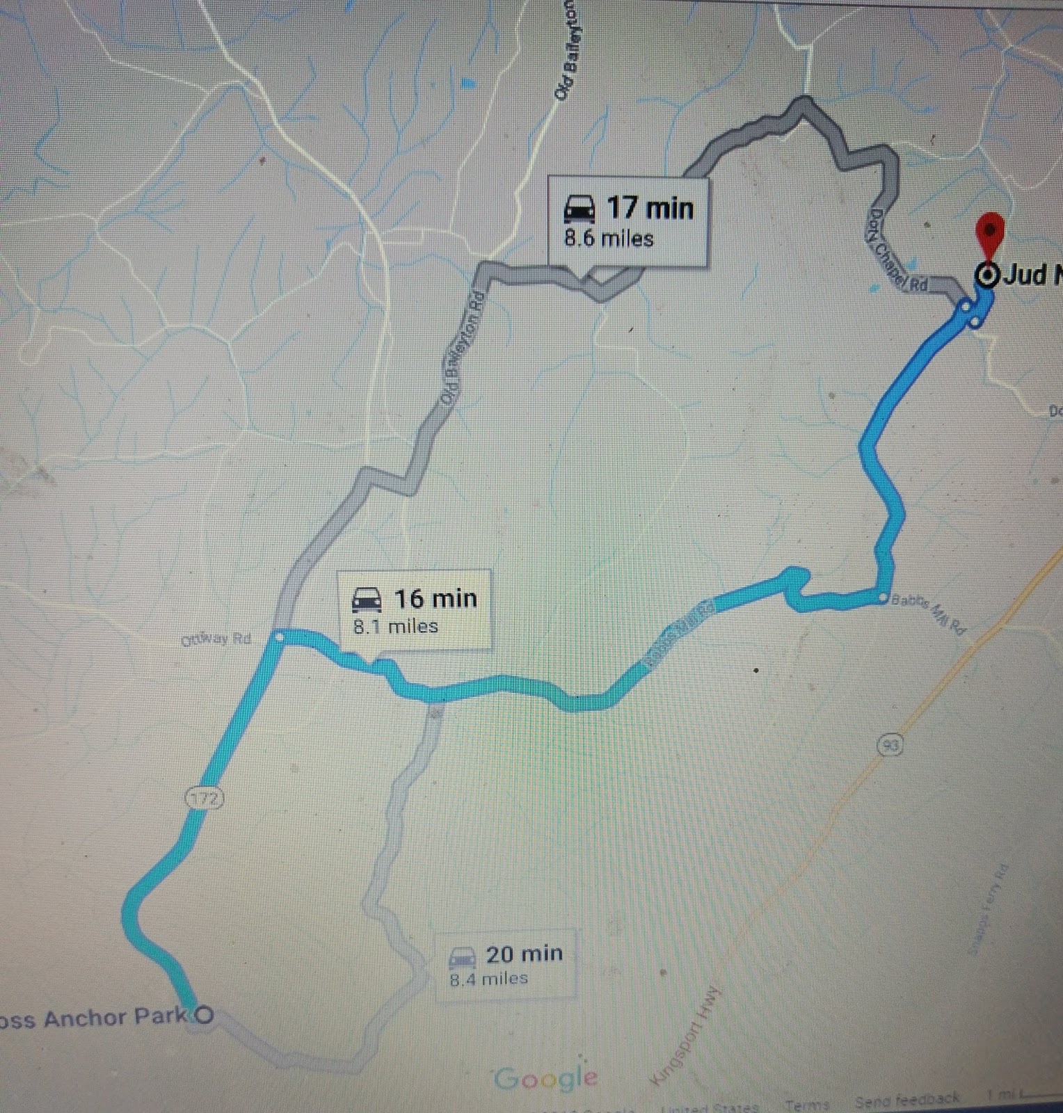
Another showing the path from the road that Jessie's body was found on to where numerous things had been discarded on Betsey Ross Road.
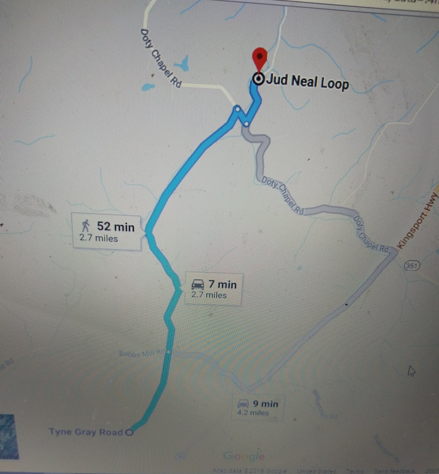
This is from the road Jessie was found on to the road where her phone case was found.These may seem redundant but I prefer to be thorough. I have also driven all of these routes and timed them to confirm the accuracy of the google maps timing.


Jessie lived in Cross Anchor Park, this shoes the distance between Food City on Snapps Ferry Road to Jessie's house. Food City is the last place Jessie was seen alive with absolute proof. There is surveillance video of Jessie and Vonda shopping there.
This is the distance from Jessie's trailer to the road where her body was found. The groceries her and Vonda had purchased were found sitting in her kitchen floor without bags.

This is the distance from Vonda's house on Davis Valley Road to Jessie's trailer, and below is the distance between Vonda's house and the road Jessie's body was found

People try to eliminate Vonda due to the small time frame, but as you can see, these are small distances. Vonda's house is minutes from the crime scene and where all of Jessie's things had been discarded. Maybe that is a coincidence, but I doubt it. The next blog post I'm going to go over forensics, things found and tested.
Until next time...
No comments:
Post a Comment